There were a number of interesting sights during our drive to Medora, ND.
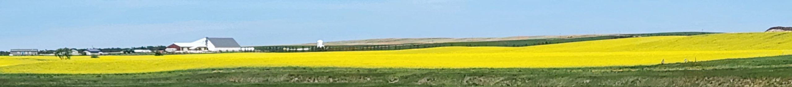
We saw lots of fields that were a vivid yellow, and decided that there was so much of it that it couldn’t possibly be mustard. A bit of research revealed that this is rapeseed (aka canola)
The eastern side of the state is quite flat, and it appears that compels the residents to create roadside attractions, such as these two along I-94
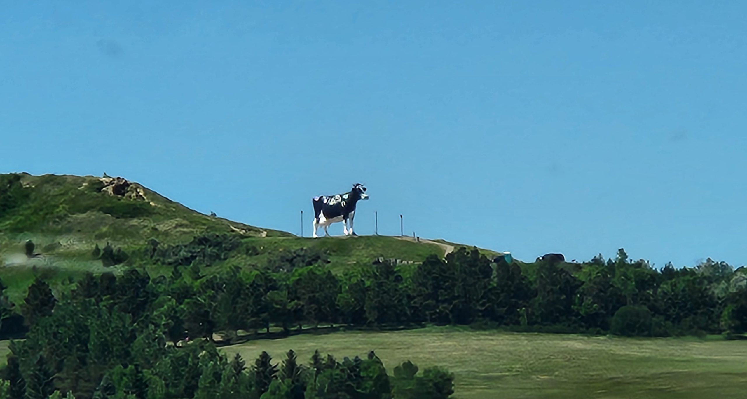
Research reveals that the above cow is named “Salem Sue” and is 38 feet tall and 50 feet long and is supposed to be “The world’s largest holstein cow”
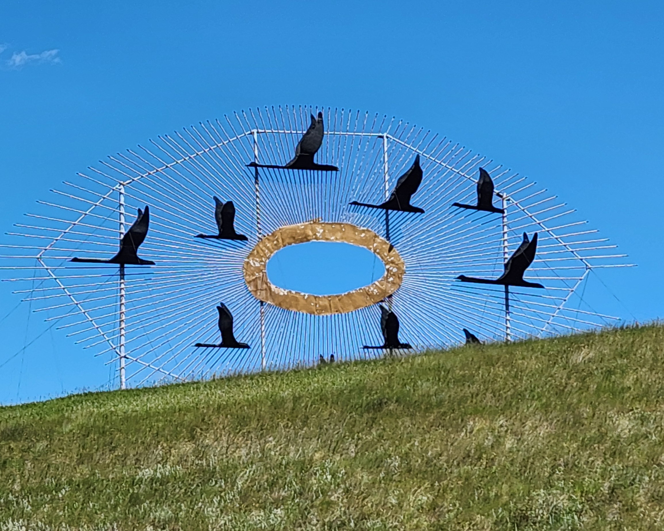
There is also a highway labeled as the “enchanted highway” that has a number of giant metal sculptures, including the following one at the junction of I-94, and titled “Geese in Flight”. Here is the picture we took of it as we drove by
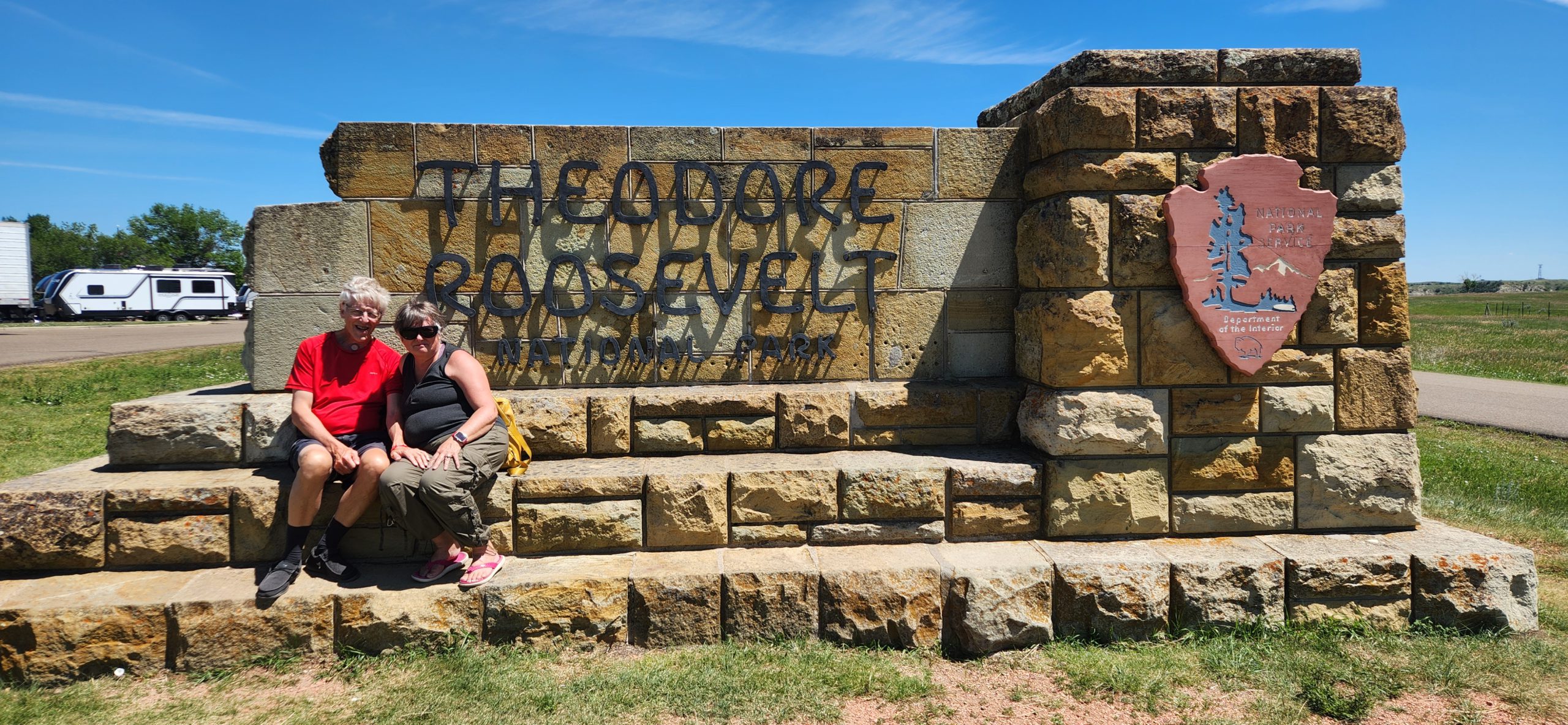
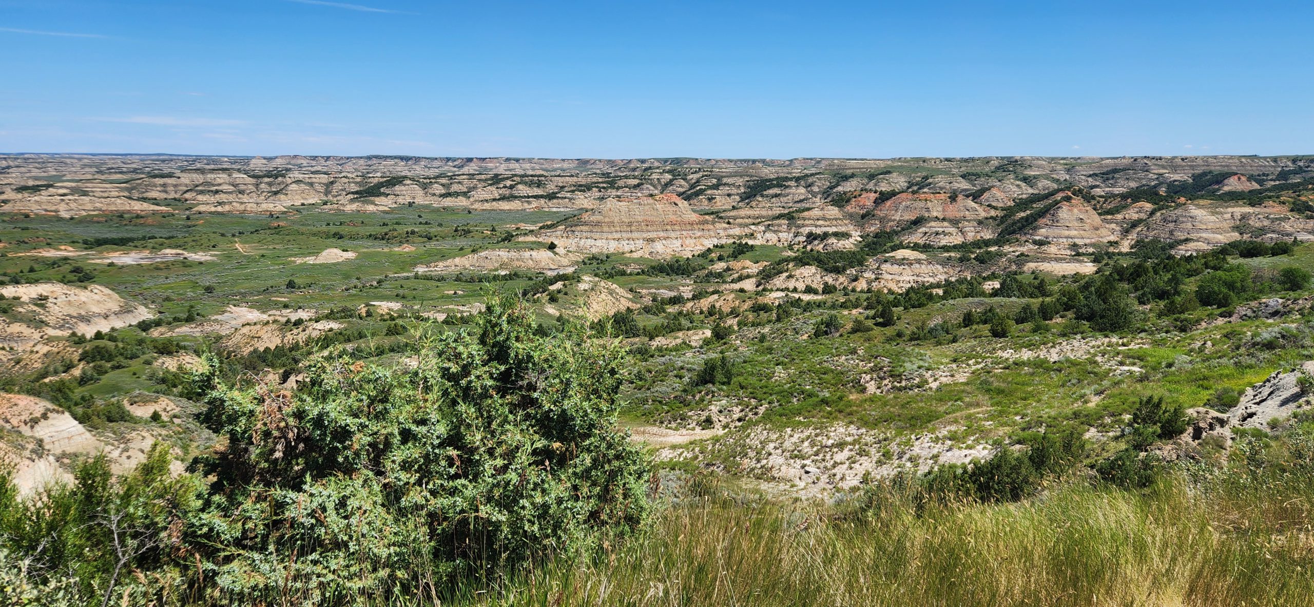
During my initial planning, I understood that all of North Dakota was in the Central time zone. Not so! Turns out that Medora is on Mountain time. The practical consequence is that we were going to reach our next campground well ahead of the check-in time. A quick check on the National Park Service app confirmed that there was “bus and RV parking” at the “Painted Canyon Visitor Center” which was along our route toward the campground. We listened to a park ranger talk about the area, and then hiked one trail.
We then moved on to the “south unit visitor center” where we looked at the exhibits, and watched the park movie.
Claudette’s 2 Cents
I loved our drive from Bismarck to Medora. The topography changed quite a bit along the way. As Bernard pointed out, we passed acre upon acre of farmland. I was overjoyed to see so many vibrant yellow fields. At first, I thought they were mustard—I’ve seen mustard fields before—but the farther west we drove, the more I began to doubt it. Surely no one in the U.S. eats that much mustard!
Curious, I asked Bernard to look up the Canola flower—and bingo, that was it. Fields and fields of blooming canola.
Another highlight? Watching the barley fields (or what I think was barley) ripple in the breeze. The wind created a wave-like effect that was mesmerizing. It reminded me just how vital farming is in North Dakota. We saw so many massive silos—sometimes 10 or more clustered in one spot—which makes sense. It allows farmers to store their crops locally instead of transporting them long distances. We also passed several train tracks with crop cargo ready to be hauled away.
As we approached Theodore Roosevelt National Park, the landscape changed dramatically. The flat farmlands gave way to eroded soil formations and striking hoodoos—classic features of what’s known as the Badlands.
I really enjoyed the Painted Canyon Visitor Center. I stocked up on stickers for my journal and added new stamps to my National Parks Passport book—it’s getting pretty full now! While there, we decided to take a “short” hike to explore the area. I’m so glad we wore our hiking boots, hats, sunscreen, and packed plenty of water. (Note to self: Always gear up, no matter how short the hike seems.) What was supposed to be a 15–20 minute nature walk turned into more than 30 minutes. We eventually turned around, and I’m glad we did before it got too far off-track.
We then continued on to the main part of Theodore Roosevelt National Park, where we parked the RV and watched a documentary about Roosevelt’s life. We’ve also been listening to Leadership in Turbulent Times by Doris Kearns Goodwin, which explores Roosevelt’s early years and how his time in the Dakotas shaped him. Having that context made our visit feel even more meaningful. We also visited the Maltese Cross Cabin, where Roosevelt once stayed. It was tiny—and I can’t imagine it was very warm.
Best of all? Our campground is literally right next to the park—less than two minutes away (and that’s only because of the construction!).
Here are a few photos of the park and area.


